Hop growing on the Pader

Agriculture & Fishery

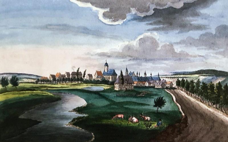
Background image: View of Neuhaus, c. 1820/30, watercolour by Friedrich v. Mengersen (Stadt- und Landesbibliothek Dortmund/ Residenzmuseum Schloss Neuhaus, photo M. Ströhmer 2019)

On the peri-urban headwaters of the Pader, which passed the city wall in a northwesterly direction, customary agriculture and cattle-breeding was practised since the High Middle Ages. The riverine free float of arable, grass and garden areas was, until the beginning of the 19th century, divided between secular and spiritual landlords: On the south bank of the Pader, between the old „Neuhäuser Weg“ and the river, the parcels of the episcopal „Tafelgut“ extended until the 18th century (former villication „Enenhus“).[1] Since the Middle Ages, mostly the main varieties rye, barley and oat were grown on these „fürstliche Ackerbreiten“ (princely farmlands; the title „prince“ denotes a male). In the 17th century, the Bishop had the complex re-measured and converted to gardens and smaller arable plots.[2] Especially here, in the west of the „Feldmark“ (parish land) of Paderborn, the property of the territorial sovereign concentrated along the old „Neuhäuser Weg“.

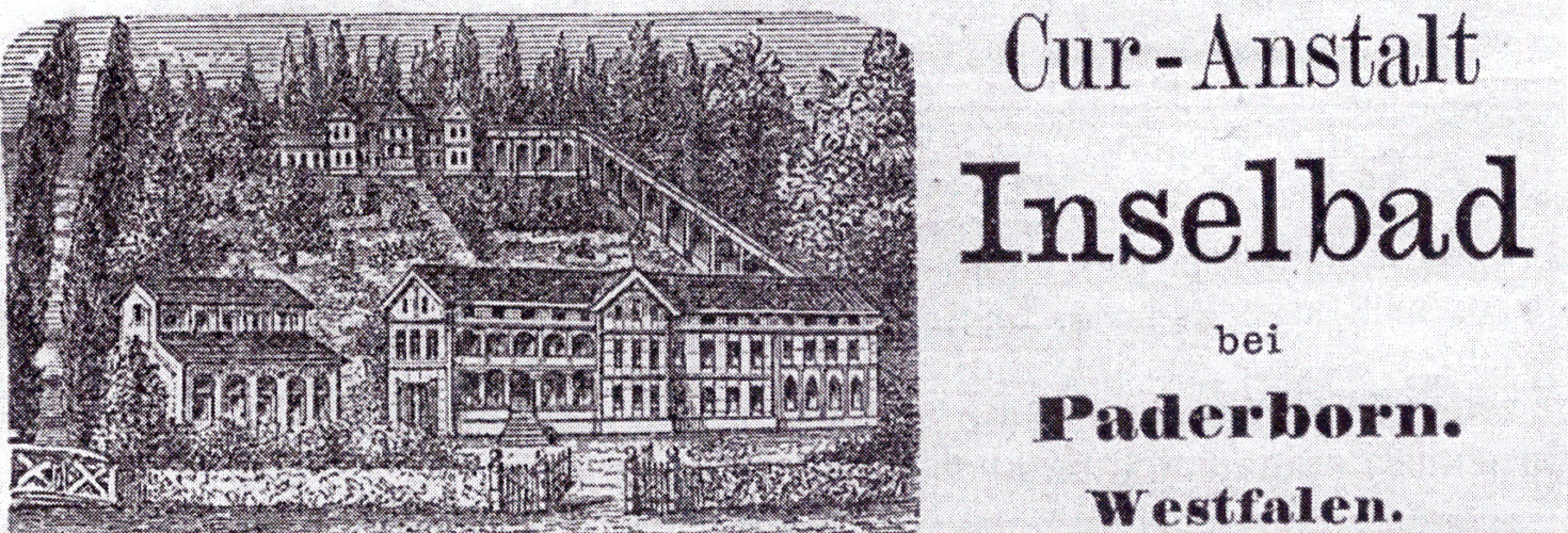
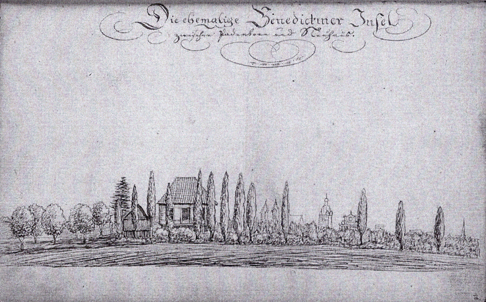
North of the peri-urban Pader, more episcopal leased land was located, namely the „Mönchsinsel“ or „Benediktinerinsel“ on the „Rothebach“, which went from the noble family von Kanne to the Benedictine monastery „Abdinghof“ between 1709 and 1727.[3] On this meadow plot, around the „Ottilienquelle“ (Ottilia spring), the first public baths of Paderborn were established between 1842 and 1912. They were followed by the closed „Curanstalt Inselbad“ (Sanatorium Inselbad).


Also at the beginning of the 18th century, the Abdinghof Monastery acquired several meadows and (cabbage)gardens west of the „Riemeke-Bach“ (Riemeke brook).[4] Here, as in the surrounding area of the town of „Schloss Neuhaus“, hops had been grown since the 16th century as a special crop for monastic and bourgeois beer breweries (1743: „Hopfengahrte“).[5] Its yields probably helped to ensure that Paderborn beer became one of the city’s main exports alongside bread and grain until the outbreak of the Thirty Years’ War. [6] In regard to the structure and use of the „Neuhäuser Feldmark“ (Neuhaus parish land), which lay on the lower reaches of the Pader, an anonymous chronicler noted for the late 18th century (1797)[7]:

„Neuhaus lies on a plain, and is surrounded by the rivers Alme, Lippe and an arm of the Pader. Before the Pader reaches Neuhaus, it divides into two arms. […] The ground of Neuhaus is level and sandy; one part consists of meadows; in kitchen gardens that produce all kinds of vegetables; in soils, which bear wheat, rye, barley, oat, buckwheat, flax etc., finally heath, from which peats are cut for burning […].“[8]

To supply the royal court, the „Küchenamt“ (kitchen office) maintained its own hop garden (“Am Hoppenhofe”) south of the hamlet, between the Alme and Pader rivers. [9] This probably enclosed garden was cultivated by a specially employed “Hoppener”. Together with farmers from the market town of Neuhaus and the villages close to the town (“Küchenamt Neuhaus”), who were obliged to perform manual labour, he took over the spring tilling and harvesting.[10]

For this purpose, hundreds of hop poles were transported to Neuhaus in the 18th century by farmers from Neuhaus, Elsen, Thune or Sande who had draught animals at their disposal („spannfähige Bauern“). The wood was cut in the forest „Bekener Forst“/„Neuwald“ (near the towns of Neu- and Altenbeken), from where it had to be brought in using horse-drawn vehicles.[11] As early as in the 1680s, a path led to this field garden over a Pader bridge ( „Höpperbrücke“), which crossed the river west of the location where the „Rochus-Kapelle“ (Rochus Chapel) was built in 1767.[12]


[1] Cf. Balzer, Manfred: Untersuchungen zur Geschichte des Grundbesitzes in der Paderborner Feldmark, München 1977, map 1.

[2] Cf. Balzer, Untersuchungen, p. 619ff.

[3] Cf. Völkel, Jana/ Fäßler, Peter E.: Die Ottilienquelle, das Inselbad und die „Curanstalt Inselbad bei Paderborn“, Dokumentation Paderborn 2014, p. 1-34, here p. 6.

[4] Cf. Balzer, Untersuchungen, p. 90.

[5] For a brief summary of hop growing see Detten, Georg von: Westfälisches Wirtschaftsleben im Mittelalter, Paderborn 1902, p. 56f.

[6] For information on the the market conditions in the Late Middle Ages cf. Schoppmeyer, Heinrich: Die spätmittelalterliche Bürgerstadt (1200-1600), in: Jarnut, Jörg e. a. (Ed.), Paderborn, Geschichte der Stadt in ihrer Region, Vol. 1: Das Mittelalter, Paderborn 1999, p. 199-473, here p. 348-355. For information on the market situation in the Early Modern Age cf. Ehrenpreis, Stefan/ Horstkemper, Gregor: Paderborn im Zeitalter der frühmodernen Landesherrschaft und der Konfessionalisierung, in: Göttmann, Frank e. a. (Ed.), Paderborn – Geschichte einer Stadt in ihrer Region, Vol. 2: Die Frühe Neuzeit, Paderborn 1999, p. 60-147, here p. 69f.

[7] Excerpts edited by Michael Pavlicic: Eine Neuhäuser Chronik aus dem Jahr 1797, in: Die Residenz 86 (1986), 87-88 (1987), p. 11-19; p. 3-11; p. 46-48.

[8] N.N.; Description of town „Schloss Neuhaus“ (draft after 1795), EAB Pb, AV Acta 88, fol. 55-100, here fol. 56r, 97r.

[9] Cf. field map of Gemeinde Neuhaus, Flur VI „Nassewenne“ (original survey 1829/30). Kreis Paderborn, Amt für Geoinformation, Kataster und Vermessung, Nr. 2955-01-FL 06 00. The mention of a master „Hans“, noted as „baker and brewer“ on the list of the servants in the official accounts of Schloss Neuhaus 1445-47 provides early evidence of the castle’s self-reliant economy. Cf. Rade, Jürgen: Die Bewohner des Schlosses Neuhaus nach den Rechnungen des Amtes Neuhaus von 1445 bis 1447, in: Pavlicic, Michael (Ed.), Studien und Quellen zur Geschichte von Stadt und Schloß Neuhaus, Vol. 1, Schloss Neuhaus 1994, p. 21-30; here p. 24.

[10] Early mention of a „Hoppener“, who was part of the common „Huißgesinde“ (household servants) of the castle and paid on a yearly basis, in the official account of 1562/63. LA Münster, Fürstbistum Paderborn, Ämterrechnungen Neuhaus Nr. 1040, fol. 56r. At the beginning of the 17th century, 17 hop pickers are listed, who did the harvesting for eight days and were paid 3 Pfennige per day. Cf. Amtsrechnung 1606/07, LA Münster, Fürstbistum Pb, Ämterrechnungen Neuhaus Nr. 1050, fol. 116v.

[11] Cf. Henning, Friedrich-Wilhelm: Bauernwirtschaft und Bauerneinkommen im Fürstbistum Paderborn im 18. Jahrhundert (Schriften zur Wirtschafts- und Sozialgeschichte, Bd. 18), Berlin 1970, p. 129.

[12] Cf. the Pader map of the Jesuit Johannes Grothaus around 1680. Printed in Koch, Josef: Frühe Verkehrsstraßen in der östlichen Westfälischen Bucht. Straßengeschichtliche Untersuchung zur Verkehrslage der Stadt Paderborn (Schriftenreihe des Heimatvereins Neuenbeken, Bd. 3), Paderborn 1977, p. 248f. The name „Höpper“-bridge can be interpreted ambiguously in Low German: It might be translated as „Hopfner“ (hop gardener) or „Hopfen“ (hop) -bridge, but „Höpper“ is also the regional word for a frog, which certainly was native to the Pader meadow of Neuhaus. Friendly hint by Mr. Michael Pavlicic (Sept. 2020).

Learn more about Agriculture & Fishery on the Pader

Download essay

This is an excerpt from an essay by the historian Prof. Dr. Michael Ströhmer. The original title of the essay is: "Wirtschaftsregion Pader - Eine geschichtswissenschaftliche Skizze (1350-1950)". Should you have further interest in the economic history of the Pader, we recommend downloading the complete essay (PDF file).

To the contact form

Have you discovered a topic related to the Pader that has not yet been mentioned? We would be delighted if you would help us to bring "light into the darkness". So please feel free to send us your own articles about the Pader!